
What rain runoff, the National Flood Insurance Program, and flood-hazard maps mean for homes and businesses.
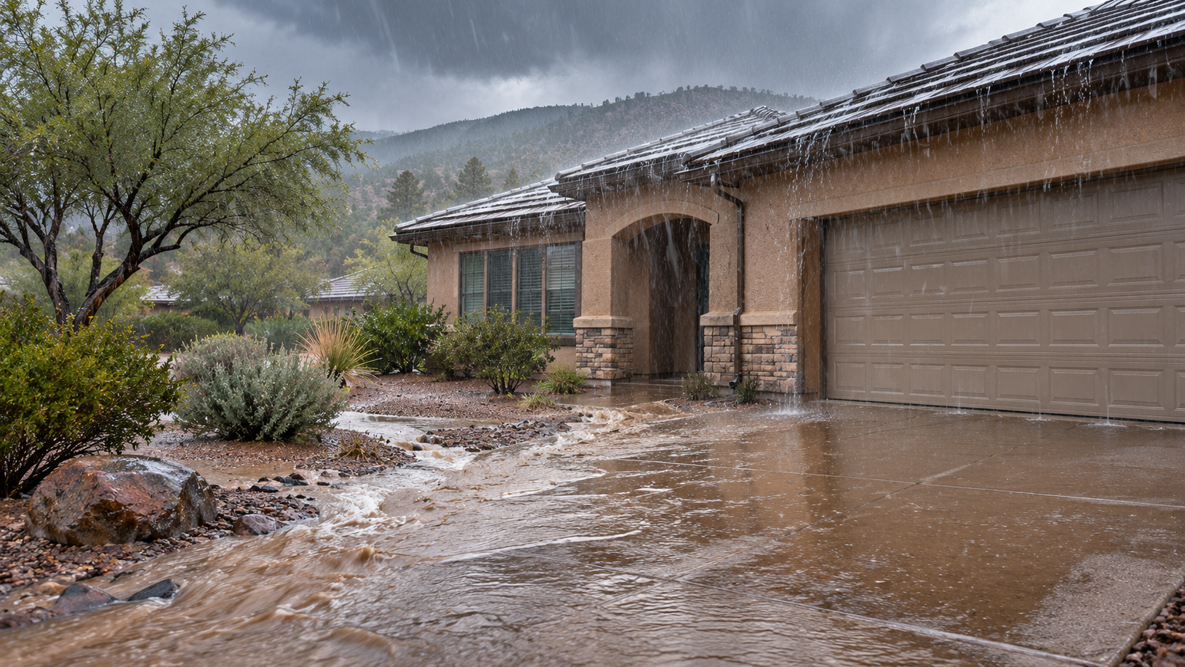
When heavy rain hits, the most consequential insurance question may not be how much rain fell. It may be how the water reached the building. Runoff can travel across hard ground, down a sloped driveway, through a garage opening, or beneath an exterior door, without ever leaving its banks.
During the November 1, 2026, storm, the National Weather Service warned of flash flooding across northern and central Arizona, with especially heavy rainfall possible along and south of the Mogollon Rim. The immediate safety risk is real. So is a frequently misunderstood insurance gap: ordinary property insurance generally does not provide flood protection simply because the water came from a severe rainstorm.
Surface water is the issue, not whether the water is natural
A broad statement that “naturally occurring water is excluded” would be inaccurate. Rain, hail, and wind are natural events, yet some resulting property damage may be insured. The more useful distinction is the mechanism: water accumulating or flowing over the ground and entering a building at ground level commonly falls within a flood or surface-water exclusion.
Arizona’s Department of Insurance and Financial Institutions describes ground-level water flowing into a home as flooding and explains that standard homeowners coverage generally excludes it. Many commercial property policies also exclude flooding unless you purchase separate flood protection or an endorsement. Actual wording, endorsements, and the facts of the event still control.
Contrast that with rain entering through a roof opening caused by covered wind or hail damage, a sudden plumbing failure, or a sewer backup. Those situations can raise different coverage questions, including separate exclusions and endorsement requirements. A wet floor alone does not establish a common cause of loss.
The NFIP definition is narrower than everyday use of “flood”
The National Flood Insurance Program (NFIP) defines a flood in part as a general, temporary inundation of at least two acres of normally dry land or two properties, one of which is the insured property, caused by events including overflow of inland waters or unusual and rapid accumulation or runoff of surface water. The program also covers qualifying mudflow.
That distinction is important. Surface water may be excluded under an ordinary property policy without establishing that the event satisfies the separate NFIP definition. Conversely, a mapped flood zone is not a prerequisite to every qualifying NFIP flood claim. Do not transfer a definition from one policy to another or assume that any puddle or isolated leak qualifies for federal flood benefits.
Flood insurance is separate protection, with its own limits
Flood coverage may be available through the NFIP or a private insurer. Under common NFIP limits, eligible one- to four-family residential buildings may be insured for up to $250,000, with up to $100,000 for contents. For eligible business buildings, NFIP limits can reach $500,000 for the building and $500,000 for business contents. Building and contents are separate coverage selections; the maximum amounts are not automatically the limits purchased.
The NFIP also has significant restrictions. Basement property receives limited coverage, temporary living expenses are not included, and the standard NFIP policy does not cover business interruption or loss of use. A private or excess flood policy may provide different terms, limits and available extensions. Compare the actual contracts before relying on a general description.
Timing matters. A new NFIP policy generally has a 30-day waiting period, with defined exceptions. Purchasing a policy during an ongoing storm should not be assumed to cover damage from that storm. Ask the insurance agent to confirm the applicable effective date, any exceptions, and the available protection before a future event.
Flood maps are useful, but they are not a water barrier
FEMA’s Flood Insurance Rate Maps identify mapped hazard areas and help property owners evaluate flood risk and certain lender requirements. They do not forecast today’s runoff, prove that a particular building is safe, or resolve a claim under a particular insurance contract. A property outside a mapped high-risk area can still flood, particularly where drainage patterns, nearby development, burned slopes or local terrain change the flow of water.
Two useful public tools are:
FEMA Flood Map Service Center — Search official flood maps by address
Yavapai County Flood Hazard Mapping — View local flood-hazard GIS layers
The county viewer applies to Yavapai County; readers elsewhere should use FEMA’s national map and consult their own floodplain administrator for local studies. Treat maps as screening tools, not insurance coverage determinations.
What to document if water reaches your property
Safety comes first. Do not drive across flooded crossings, enter moving floodwater or approach submerged electrical equipment. When it is safe, photograph the exterior water levels, the direction of runoff, entry points, watermarks, damaged building components and affected contents. If available, preserve evidence showing whether adjacent properties or roadways also flooded. Keep photographs of distinct wind, roof, plumbing or drainage damage separate rather than assigning every wet area the same cause.
Notify the insurer promptly, describe what was actually observed, and preserve mitigation invoices, photographs, correspondence and any inspection records. Take reasonable protective action when safe; do not postpone urgent measures just to wait for an adjuster. Where the cause or policy response is disputed, request a written explanation identifying the relevant policy wording and the facts relied upon.
The bottom line
Heavy rain does not automatically create an insured loss, and a surface-water exclusion does not answer every water-damage question. The source, direction and point of entry of water, any separate flood policy, and the actual insurance provisions determine what needs to be investigated. The right time to compare flood coverage is before the next storm.
Absolute Adjusting provides general property-claim education for residential and commercial property owners. This article is not a coverage determination or legal opinion; the operative policy, documented loss facts and applicable authority control.
Sources and further reading
Arizona Department of Insurance & Financial Institutions — Homeowners Insurance
Arizona DIFI — Specialty Insurance / Flood Insurance
National Flood Insurance Program — Flood definition
NFIP — Buy a Policy (limits and waiting periods)
National Association of Insurance Commissioners — Flood Insurance
NFIP — Protecting Businesses with Flood Insurance
National Weather Service Flagstaff — Current warnings and forecasts